The Forest Preserves of Cook County manages nearly 15,000 acres of regulatory floodplain directly adjacent to major streams and rivers.
On this page:
- Overview
- Natural Floodplain Management
- Managing Stormwater with Green Infrastructure
- Ponds, Lakes, & Sloughs
- Stormwater Management & Biodiversity
- Flooding
- Land Use Requests
- What Can Landowners Do?
- Additional Resources
Overview
In accordance with its mission, the Forest Preserves is managing these floodplain lands for the purpose of protecting and preserving public open space in a natural state. All Forest Preserve lands receive, on average, about 37 inches of precipitation a year. When this precipitation meets the land, it can either infiltrate the soil or become stormwater runoff. The Forest Preserves is focused on managing precipitation where it falls, before it becomes stormwater runoff.
As the largest landowner in Cook County, the Forest Preserves is a stakeholder in county and regional floodplain and stormwater management. The lead floodplain and stormwater management agency in Cook County is the Metropolitan Water Reclamation District of Greater Chicago (MWRD). MWRD has prepared and adopted the Cook County Stormwater Management Plan and the Cook County Watershed Management Ordinance.
Natural Floodplain Management
The benefits of natural floodplain management are well documented. Below are a few examples:
From the 1987 report “Interagency Flood Hazard Mitigation Report for Illinois” (in response to the August 21, 1987 disaster declaration, FEMA-798-DR-IL, covering the counties of Cook and DuPage) prepared by the Interagency Hazard Mitigation Team:
Aerial surveys of the 1986 flood demonstrate that the Forest Preserve lands in Lake and Cook counties reduced the property damage along the Des Plaines River. These tracts of land, owned and managed by the Forest Preserve Districts of Cook and Lake counties, acted as vast natural “sponges” along the floodplain of the Des Plaines River. As flood waters rose, they spread into the surrounding Forest Preserve lands which cushioned the impact on adjacent towns. In terms of public benefit, money spent on forest preserve acquisition is a cost-effective mitigation measure which will produce long-term benefits far in excess of the initial program costs.
From the 1988 report “An Evaluation of Floodwater Storage” prepared by Charles Ford and John Sheaffer:
[The Forest Preserve District of Cook County] has forestalled the creation of many flood damage areas and reduced demands for flood control expenditures simply by buying up the fine natural forests that grow in the floodplain and adjoining low land. The acquisition of vacant floodplain lands at strategic locations and preserving them in their natural state is a cost-effective means of providing the multiple benefits of flood hazard mitigation, open space and recreation, and wetlands habitat protection.
From the 1996 publication “Protecting Floodplain Resources – A Guidebook for Communities” prepared by the Federal Interagency Floodplain Management Task Force:
Floodplains and wetlands can play an important role in contributing to sources of water supply for human consumption. The slowing and dispersal of runoff and floodwater by floodplain vegetation allows additional time for this water to infiltrate and recharge groundwater aquifers. Floodplain soils and vegetation can also help to purify the water as it filters down to the aquifer. The ability of wetlands to contribute to groundwater recharge varies with geographic location, season, soil type, water table location and precipitation, as well as wetland type.
From the 2006 publication “Illinois Floodplain Management Desk Reference” prepared by the Illinois Association for Floodplain and Stormwater Management:
Over the centuries, floodplains develop their own ways to handle flooding and erosion with natural features that provide floodwater storage and conveyance, reduce flood velocities and flood peaks, and curb sedimentation. Natural controls on flooding and erosion help to maintain water quality by filtering nutrients and impurities from runoff, processing organic wastes, and moderating temperature fluctuations. These natural controls also contribute to recharging groundwater by promoting infiltration and refreshing aquifers and by reducing the frequency and duration of low surface flows.
Managing Stormwater with Green Infrastructure
As an agency focused on the acquisition, restoration, and management of natural open space, the Forest Preserves is necessarily interested in predevelopment, groundwater-based hydrology. As part of land development and redevelopment projects, site-scale green infrastructure practices are the preferred stormwater management strategy. Green infrastructure uses vegetation, soil, and natural processes to manage rainwater where it falls.
By integrating vegetation, soil, and natural processes, green infrastructure can meet stormwater management goals, while simultaneously providing benefits related to wildlife, habitat, energy, climate change, community, and air quality.
Below are examples of Forest Preserves projects that encourage rainwater infiltration and soil stabilization, preventing runoff and soil erosion.
- Penny-Healy Prairie Restoration: Removal of non-native vegetation and installation of native vegetation, which upon establishment, will increase on-site infiltration of precipitation.
- River Trail Nature Center Shoreline Stabilization: Removal of a failing sheet pile retaining wall and installation of a more natural rough limestone slab shoreline stabilization treatment, which will limit future shoreline erosion.
- Picnic Grove Drainage & Accessibility Improvements: Installation of french drain systems at 10 picnic groves to reduce localized ponding, which will capture, treat, and infiltrate stormwater runoff.
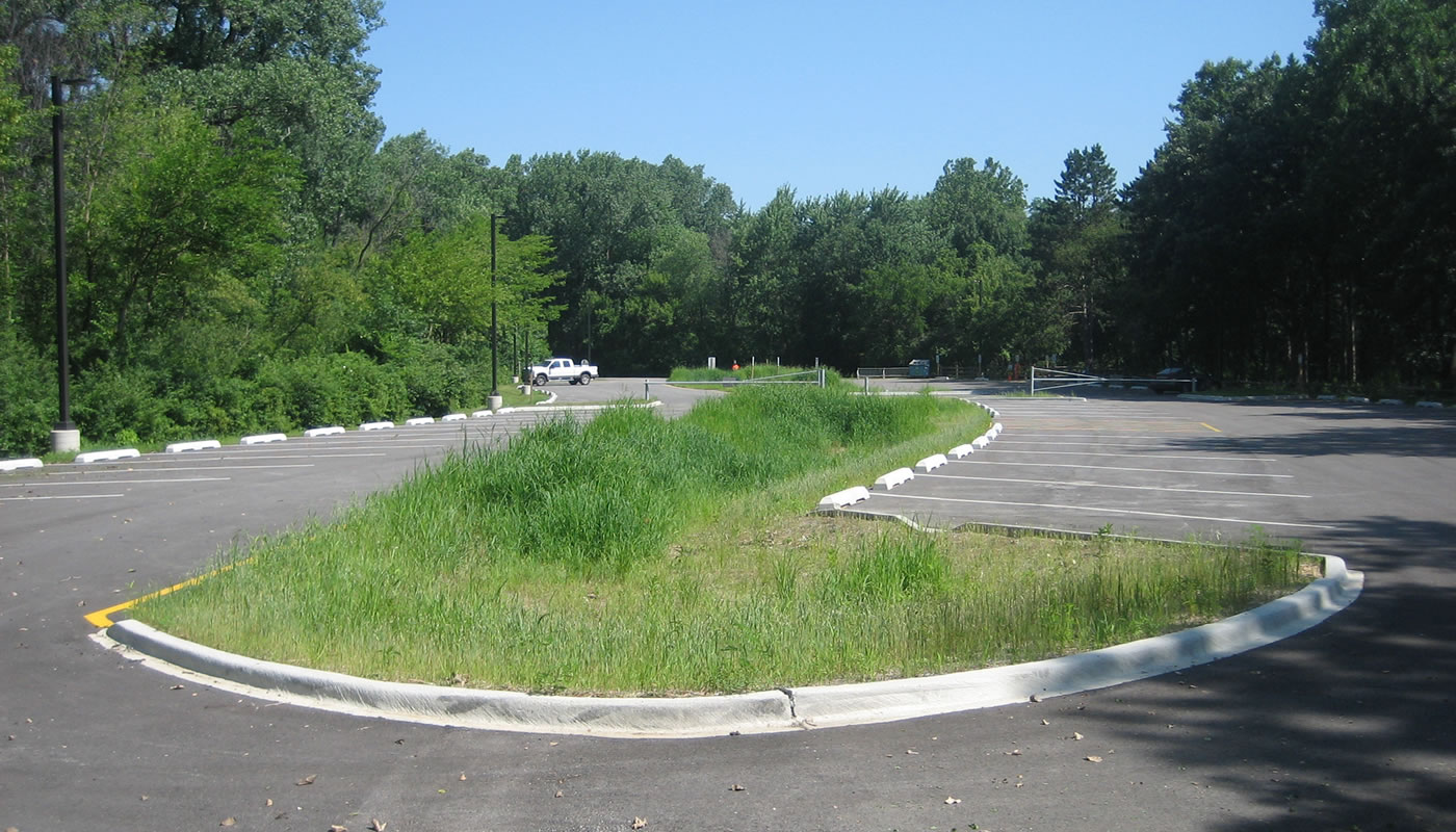
- Parking Lot Improvements: Sand Ridge Nature Center, Thatcher Woods, and Trailside Museum parking lots were reconstructed and repaved to reduce impervious surfaces, add bioretention and landscape islands, and provide distributed sheet flow runoff to capture, treat, and infiltrate stormwater runoff.
- Repairs to Dams & Water Control Structures: There are many man-made lakes on Forest Preserves property. These lakes provide some level of stormwater detention and flood-reduction benefits. Repairs and maintenance at 14 sites will ensure continued operation.
- County-wide Trail Repairs: Repairs and maintenance to paved and unpaved trails across Cook County, which will prevent future erosion.
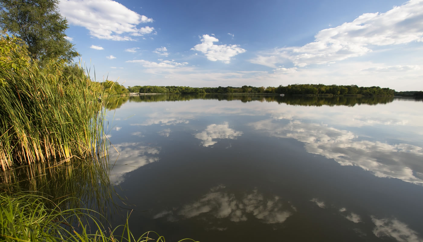
Ponds, Lakes, & Sloughs
There are many ponds, lakes, and sloughs on Forest Preserves lands. Most of these are not entirely natural. Some were created or developed by the Forest Preserves for their landscape value, wildlife value, and/or recreational uses—principally fishing. Others were borrow pits for earth fill, or quarries for stone, for highway and other construction projects. The ponds, lakes, and sloughs that were formed by constructing small dams or water control structures provide some level of stormwater detention and flood-reduction benefit.
There are two larger, historic flood-control projects on Forest Preserves lands: Skokie Lagoons and Busse Reservoir. The Skokie Lagoons were once a large marsh of the Skokie River, but construction of several dams formed the lagoons for the purposes of recreation, habitat, and flood control. Busse Reservoir is an on-line reservoir on Salt Creek within Busse Forest and Ned Brown Preserve. The reservoir – actually one large pool and two smaller pools – and the dams that form it, was a joint recreation, habitat, and flood-control project between the Forest Preserves, Illinois Department of Natural Resources Office of Water Resources, and U.S. Natural Resource Conservation Service. Both these projects were designed and constructed to provide recreation and habitat benefits, in addition to floodplain and stormwater management benefits.
Stormwater Management & Biodiversity
The Forest Preserves is all-too familiar with the pernicious degradation of its holdings and the threat to biodiversity from stormwater that comes from land surrounding the preserves.
From the 2000 publication “Protecting Nature in Your Community” prepared by the Northeastern Illinois Planning Commission (now CMAP) and Chicago Wilderness:
Without improved stormwater management, the integrity and quality of the region’s aquatic systems—streams, lakes, and wetlands—will continue to be degraded and remaining high quality ecosystems will be destroyed.
Conventional urban development dramatically increases the amount of stormwater runoff generated by the landscape. The principal causes of this effect are impervious surfaces—streets, parking lots, and buildings—and compaction of the soil due to construction activities. Instead of soaking into the ground, rain that falls on an impermeable surface is converted quickly to runoff and is eliminated from the site via sewers and manmade channels.
Some common site development standards may actually worsen stormwater runoff problems. For example, development standards that require wide streets, expansive parking lots, and artificial drainage systems produce even more runoff than similar developments of 40 to 50 years ago.
In recognition of the effect that increased runoff has had on flooding, new development often incorporates stormwater detention to slow the release of stormwater runoff to downstream rivers. While beneficial in controlling flood peak flows, this still leaves several runoff-related problems inadequately addressed.
Stormwater runoff is contaminated with various water pollutants that are byproducts of urban activities such as automobile use, lawn care, and industrial fallout. If unchecked, these pollutants will damage aquatic life, including fish and other wildlife species that depend on water resources for food and habitat.
Water that runs off urban landscapes cannot effectively recharge groundwater. As a consequence, wetlands and waterbodies that are naturally dependent on stable groundwater flow are subject to highly variable surface runoff causing long-term degradation. Specific impacts include a loss of sensitive plant species and a subsequent loss of wildlife habitat. Also, communities that depend on locally recharged groundwater aquifers are more likely to suffer water shortages that could limit future development and necessitate sprinkling bans and other restrictions.
Urban runoff causes instability in the drainage system by increasing the high flows, which can cause streams to rapidly erode and degrade water habitat, and decreasing the low flows (or baseflows). Reduced baseflows can cause small streams and lakes to dry up and concentrate pollutants to damaging levels.
While stormwater detention can effectively reduce runoff rates, thereby controlling localized flooding, it does little to control the increased volume of runoff caused by urbanization. As a consequence, flooding continues to worsen on larger drainage systems, such as the Des Plaines and Fox Rivers.
Flooding
Many areas of Cook County experience flooding. But, not all flooding is the same. Some common types of flooding include:
- Flooding from streams and rivers that rise up and out of their banks (overbank flooding)
- Flooding from runoff that exceeds the capacity of the sewer system
- Flooding from runoff that inundates low-lying lands which have no surface/gravity outlet
- Basement backups from flow that exceeds the capacity of the sewer system
All these types of flooding can damage public and private property.
Land Use Requests
To reduce flooding and flood-related damages, municipalities and other agencies often request the use of Forest Preserves land for construction of detention facilities, sewers, ditches, compensatory storage facilities, and levees and floodwalls. These requests are evaluated on a case-by-case basis according to the Forest Preserves Land Use Policy. In general, any project should support or further the mission of the Forest Preserves, and do no harm to Forest Preserves land.
The Forest Preserves is actively participating and partnering in many regional floodplain and stormwater management activities. If you are interested in participation or partnership, please contact the Forest Preserves.
What Can Landowners Do?
Every landowner can be a steward of their watershed, and can contribute to floodplain and stormwater management. Landowners can implement Green Infrastructure – rain barrels, rain gardens, permeable pavements, etc. – on their property, to manage precipitation where it falls before it becomes stormwater runoff.
Learn more about stormwater management through the Conservation@Home program.
Additional Resources
- Metropolitan Water Reclamation District – Stormwater Management
- Metropolitan Water Reclamation District – Stream Maintenance
- Illinois Environmental Protection Agency – Stormwater Requirements
- Illinois Department of Natural Resources – Office of Water Resources
- Illinois State Water Survey
- IllinoisFloodmaps.org
- U.S. Environmental Protection Agency – NPDES Stormwater Program
- U.S. Environmental Protection Agency – Green Infrastructure
- US Army Corps of Engineers – Illinois Regulatory Program
- Chicago Wilderness – Greening Infrastructure