The ecosystems within the Forest Preserves—many globally rare—are woven deeply into Cook County’s history and identity. Each is a unique and ever-changing wonder to learn about, enjoy and protect.
On this page:
- Overview
- Prairies
- Savannas
- Woodlands
- Wetlands
- Open Water
- Flowing Water
- Other Environments
- Other Holdings
Overview
The Forest Preserves covers more than 70,000 acres—an impressive 11 percent of Cook County.
Many forest preserves follow river valleys or creeks. Some cover rolling, wooded highlands. Still others occupy low, sandy ancient lake plains. These diverse and fascinating places support distinct communities of plants and animals, from red-headed woodpeckers and blue-spotted salamanders to Hine’s emerald dragonflies and large-flowered trillium—all species that require wild habitat to survive.
For the last 7,000 years or so, Cook County has been a subtly shifting mosaic of prairie, savanna, open woods and forests, rivers and bird-filled wetlands.
Some parts of the preserves are remnant natural communities, places where the land has been touched only lightly by modern disturbances such as grazing, logging, farming and roads. Here the land still undergoes most natural processes, expresses its original character and retains most of its plants, animals, fungi, bacteria and microscopic life. These sites help us successfully restore more degraded areas, and give us the clearest window into our natural heritage.
The ecosystems within the Forest Preserves of Cook County are something to be proud of. These prairies, woodlands and wetlands—many globally rare—are woven deeply into Cook County’s history and identity. Each is a unique and ever-changing wonder to learn about, enjoy and protect.
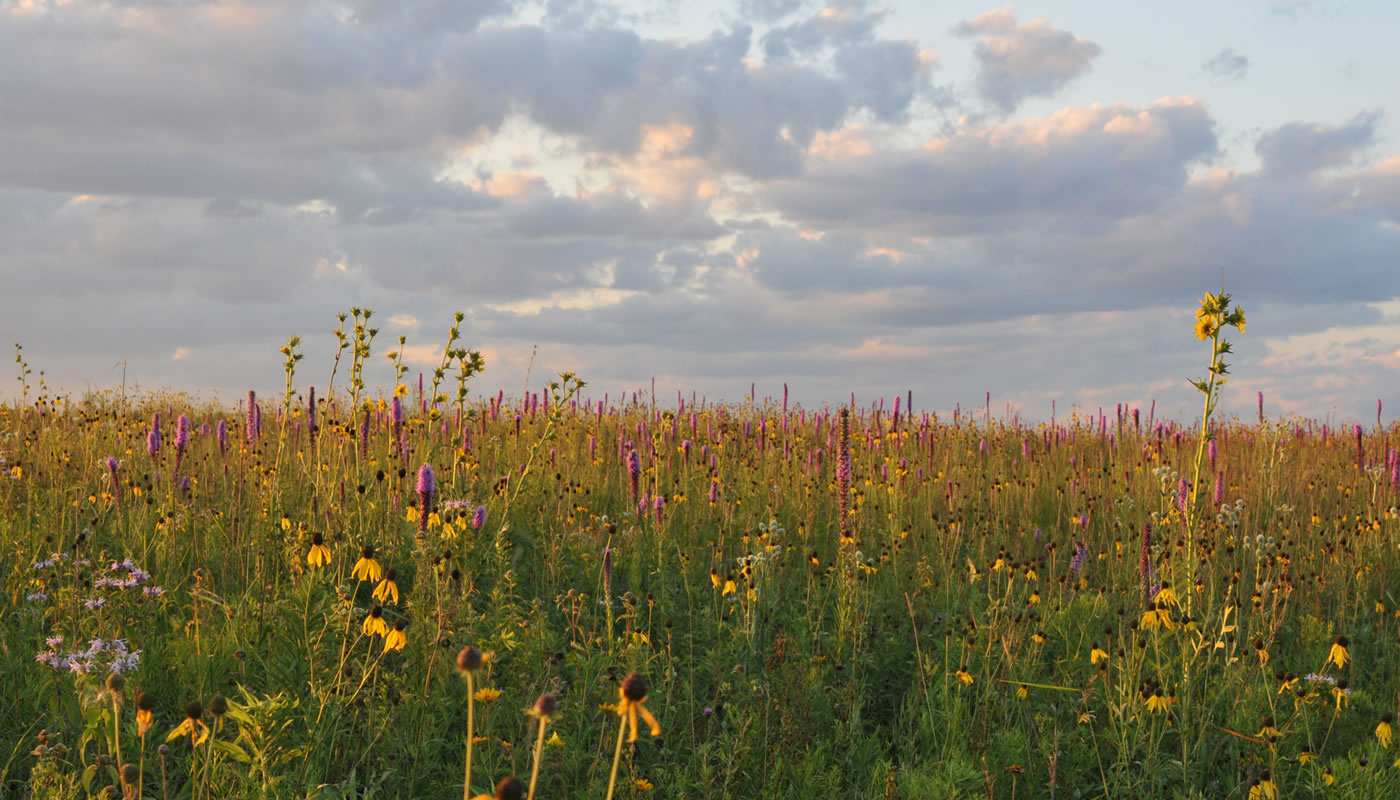
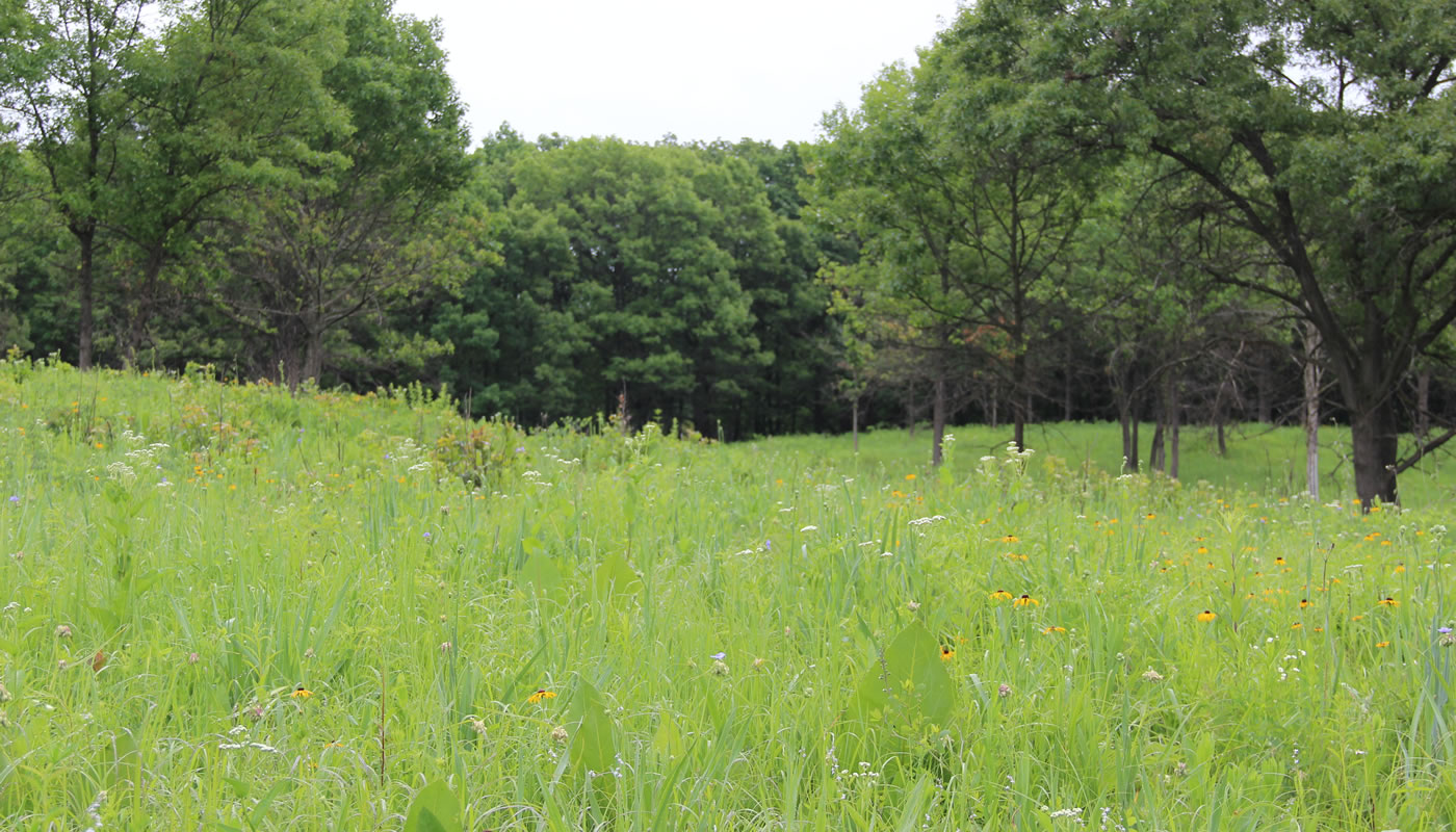
Prairies
A prairie is an open grassland with no trees. The plants of prairies are a mix of native grasses and forbs (or “wildflowers”). Historically, prairies covered much more of Cook County than any other ecosystem. From Chicago, a person could travel ten miles west through waving prairie grasses before arriving at the woods of the Des Plaines River Valley.
There are many kinds of prairie in the Forest Preserves of Cook County. A few notable varieties include:
Black Soil Prairies
Often considered the classic prairie type, most black soil prairie was plowed to farm the deep rich soil.
Where to see it:
Sand Prairies
Predominant in the Calumet region (southeast Chicago into Indiana), these well-drained prairies support dry-adapted plants and animals.
Where to see it:
Wet Prairies
Wet prairies are frequently soggy, with occasional standing water. They support plants, such as cord grass, that thrive in wet conditions.
Where to see it:
Dolomite Prairies
The soil of dolomite prairie is just a few inches deep, with dolomite limestone bedrock just beneath. Plants here are extremely hardy. In Cook County, dolomite prairie exists only along the Des Plaines and Sag Valleys.
Where to see it:
Gravel Hill Prairies
A prairie on a hill, usually one left behind by a glacier. The plants here are adapted to dry, windy, sunny conditions.
Where to see it:
Reconstructed Prairie
A prairie reconstructed from former farmland—restored through reintroduction of prairie plants and hydrological repairs (usually disabling agricultural drainage tiles).
Where to see it:
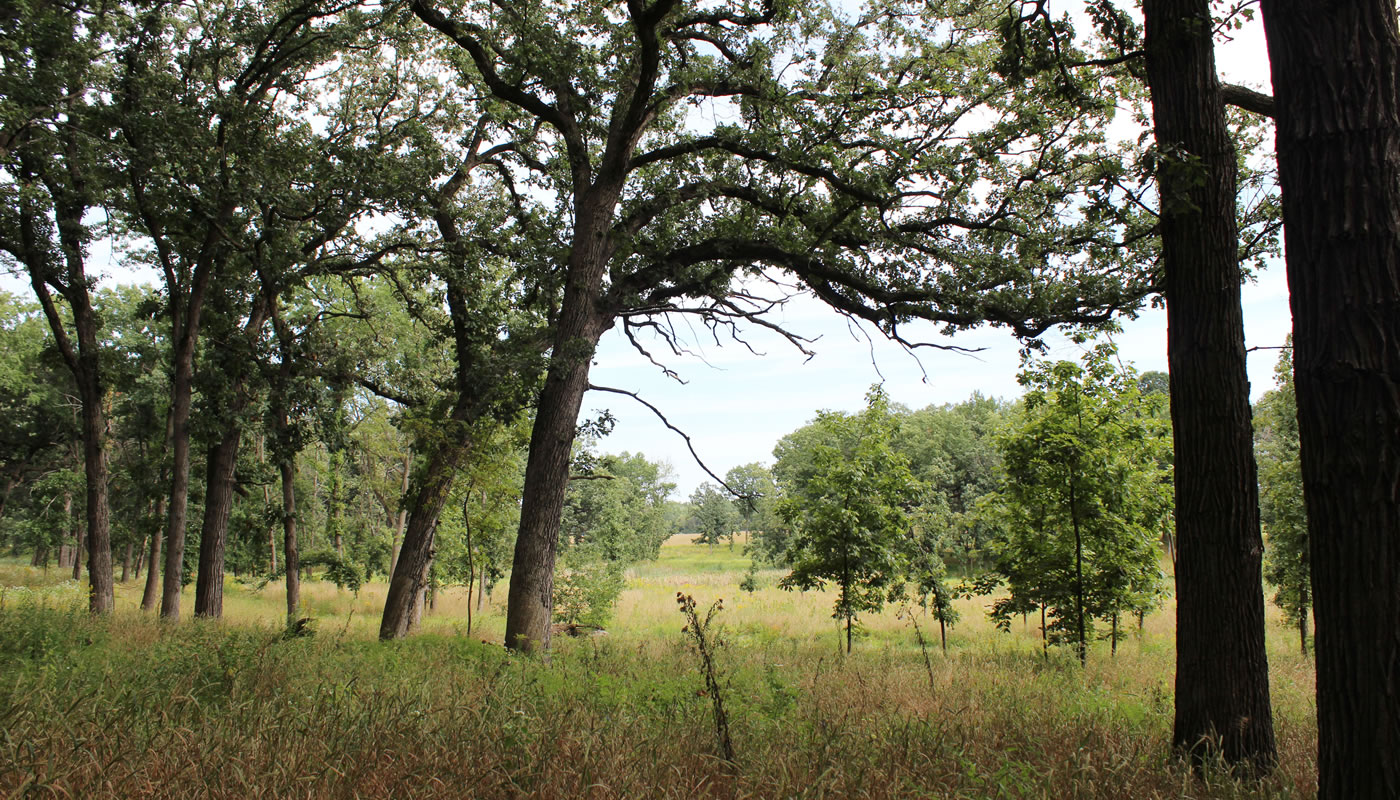
Savannas
The sun-dappled savanna landscape is a hybrid of prairie and woodland, often occurring at the transition zone where the two natural communities gain and cede territory to one another, depending on the frequency of fire.
The general appearance of a savanna is that of an open field of grass and wildflowers with scattered trees, or an occasional cluster of trees. The trees in a savanna are usually thick-barked species that can withstand occasional fire, such as bur oak.
Some specific savanna types include:
Sand Savannas
In southeast Cook County’s Calumet region, sand savanna is often found on dry sandy ridges between wetlands. If dominated by black oaks, it may also be called black oak savanna.
Where to see it:
Bur Oak Savannas
More typical of black-soil areas, with many species of tallgrass prairie.
Where to see it:
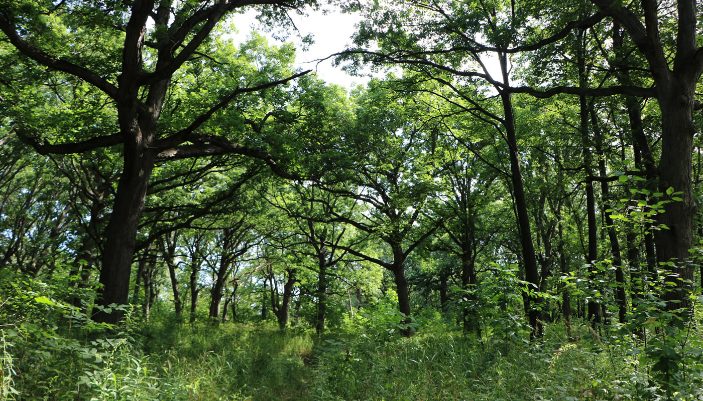
Woodlands
A woodland, or wooded community, is an ecosystem dominated by trees. In our region, various types of woodlands took hold in areas shielded, at least to some degree, from fire.
A large woodland known as the “Big Woods” once covered northeastern Cook County. Harms Woods in Glenview and Perkins Woods in Evanston were once part of the Big Woods. Another prominent woodland exists today in the Palos Preserves, in Willow Springs. Early settlers gave this highland the name “Mount Forest Island” because it resembled a wooded island rising out of a waving sea of prairie.
Wooded communities are often described by their dominant trees (oak-hickory woodland or maple-elm-basswood forest) and tree canopy density. Here are some notable woodland types in the Forest Preserves of Cook County:
Open Woodlands
The trees in an open woodland, often oaks and hickories, are spread out enough to let a significant amount of light through to grasses, sedges and forbs. In Cook County, open woodlands are often found in high rolling hills or uplands protected by small creeks. They’re also found along the outer fringes of forests along major rivers.
Where to see it:
Forests
With a nearly closed canopy, forests are even more sheltered from fire than open woodlands. You’ll often find them in river valleys and other wet areas, as well as around hills and ravines. They’re especially prevalent on the east side of these firebreaks, historically protected from the large prairie fires that were driven by prevailing winds blowing from the west. Shade-tolerant species such as sugar maple and red oak dominate our forests.
Where to see it:
Floodplain Forests
Often dominated by elm, ash, hackberry, basswood and silver maple, this forest type is found everywhere along our creeks and rivers. The plants and trees here must be able to withstand periodic flooding.
Where to see it:
Flatwoods
A flatwoods is, as the name suggests, flat. Underlain by a layer of clay that keeps water from draining well, a flatwoods is often quite wet and supports many unique species such as swamp white oak, black ash, many wetland sedges and buttonbush.
Where to see it:
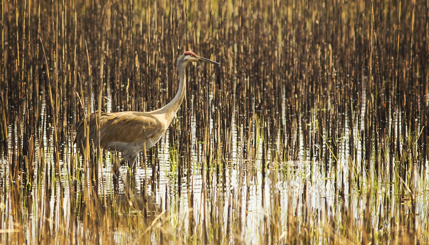
Wetlands
A wetland is just what it sounds like: land that’s either covered by or saturated with water for at least part of the year. Wetlands, particularly small ones, occur all across Cook County, often within larger prairies and woods. Many occur along rivers and other low points, while others are perched on higher ground.
Most of the region’s largest wetlands have been drained, dredged or filled. The Calumet region in southeast Cook County was famed for the wetlands around Wolf Lake, where hunters would come to hunt the plentiful waterfowl. Small remnants of these wetlands survive in places such as Eggers Grove and Powderhorn Marsh and Prairie.
At the Skokie Lagoons, canoeists now paddle over what was once one of the region’s largest and richest marshes, before it was excavated in the 1930s to create the recreational lagoons we know today.
A large wetland once occupied the Sag Valley in Palos Hills, where the Cal-Sag Channel now cuts through. It has since been reshaped to form the channel and Saganashkee Slough.
There are nonetheless many types of smaller wetlands in the forest preserves, and the Forest Preserves is in fact restoring many wetlands by disabling the tiles that farmers once used to drain them. A few notable varieties include:
Marshes
Usually a permanent body of water, surrounded by and interspersed with vegetation. A hemi-marsh has an equal amount of open water and plants, creating sheltered nooks for waterfowl to nest.
Where to see it:
Sedge Meadows
Sedge meadows are wet, open, sunny fields where sedges, a grasslike plant, dominate. Sedge meadows in the forest preserves are often near streams, lakes or other wetlands.
Where to see it:
Ephemeral or Vernal Ponds
This appears for only a short time each year, usually just a month or two in spring, depending on rain and snowfall. Because predatory fish can’t survive there, ephemeral ponds are ideal places for amphibians to breed.
Where to see it:
Fens
A rare wetland type distinguished by its alkaline, mineral-laden water. The water in a fen percolates through limestone and emerges as a seep, or spring.
Where to see it:
Bogs
A bog is an acidic wetland with very low oxygen. Usually found farther north, bogs are home to distinctive plants such as sphagnum moss.
Where to see it:
Wooded Wetlands or Swamps
A wooded or forested area with significant areas of standing water. Listen for wood ducks and tree frogs.
Where to see it:
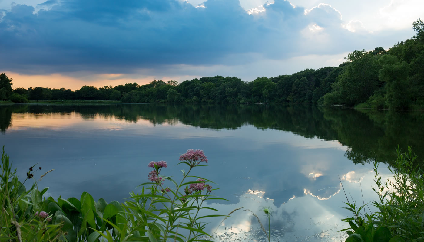
Open Water
The Forest Preserves contains many bodies of open water. While very few historically had standing water, most of them were artificially created. Many sloughs and lakes, including Long John Slough at Little Red Schoolhouse and Busse Reservoir, were created decades ago by damming slow-flowing deep-water swamps or small stream systems. Others, such as Flatfoot Lake and Powderhorn Lake, are actually “borrow pits,” giant holes excavated when sand, gravel or soil was removed for highway construction many years ago.
Although modern changes have transformed the aquatic landscape in the preserves, many species have become naturalized there and now rely on the habitat. The Forest Preserves also manages over 40 fishing areas, stocking a number of them with sport fish such as rainbow trout, sunfish and channel catfish.
Lakes
Though some bodies of water bear the name, there are no naturally occurring lakes in the Forest Preserves. Maple Lake was a wet prairie until it was dammed many years ago. Busse Lake is actually Busse Reservoir, created by damming Salt Creek.
Ponds & Sloughs
Smaller than lakes, these small water bodies are found throughout the forest preserves, notably in the Palos Preserves, but in many other preserves as well. Some are natural, but many have been created by modern hydrological changes.
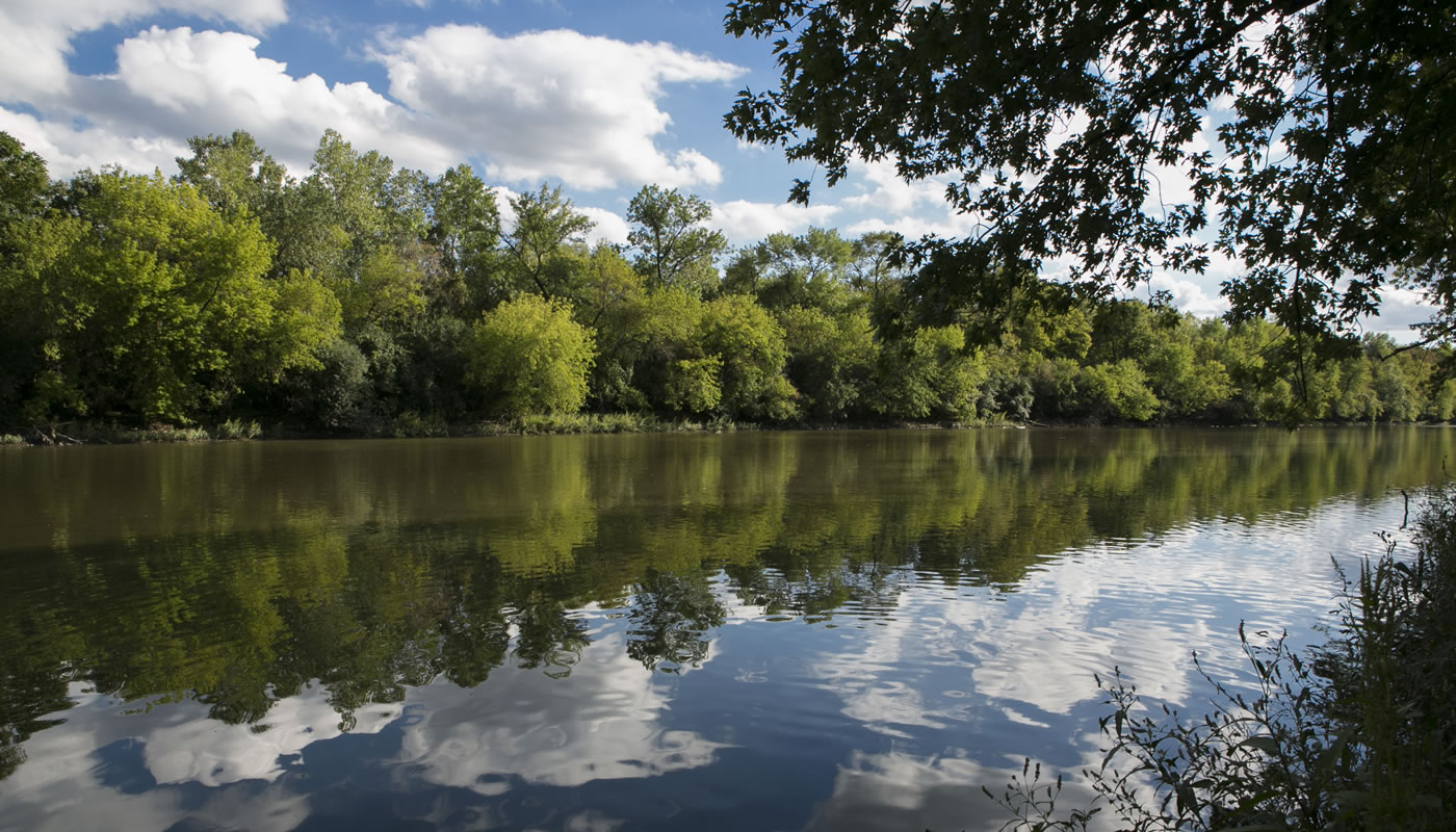
Flowing Water
Due to development and hardening of the landscape, the rivers and streams of Cook County are much wider, faster, straighter and dirtier than they once were. Yet in some places, forest preserves help reduce runoff and erosion into the rivers, contributing to healthier systems with native fish, mammals, birds, mussels and insects. The Forest Preserves is helping to remove dams from rivers to restore historic water flows and encourage natural fish migrations.
Rivers
Three major rivers flow through the Forest Preserves of Cook County: the Chicago River, Des Plaines River and Little Calumet River. Forest preserves line a majority of the upper Des Plaines, as well as the North Branch of the Chicago River.
Streams
A number of smaller streams wind through forest preserves, including Salt Creek, Poplar Creek, Thorn Creek, Crooked Creek and Tinley Creek.
Other Environments
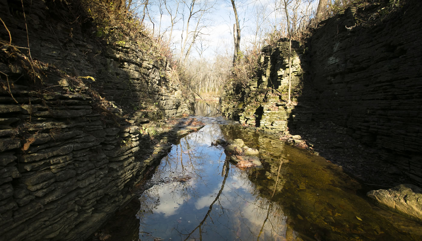
Dolomite Cliff
The walls of Sagawau Canyon, Cook County’s only canyon, support many interesting species of liverworts, ferns and other life.
Where to see it:
Bluff
The forested bluffs along the Des Plaines River Valley were carved out by ancient floodwaters.
Where to see it:
Ravine
These habitats favor species that need a sheltered, often cooler and wetter environment.
Where to see it:
Other Holdings
Not all of the open land owned by the Forest Preserves of Cook County is in a natural state.
- Old fields or Eurasian meadows. Some Forest Preserves land is former farmland known as old fields. Many old fields have transitioned into grasslands dominated by Eurasian species, and will undergo habitat restoration.
- Unassociated woody growth. The Forest Preserves is working to restore many areas that have been overtaken by invasive species to healthy natural condition. These areas are often labeled “unassociated woody growth” because they are dominated by woody species such as buckthorn and honeysuckle that don’t belong to any native community.
- Reforestation. Decades ago, the Forest Preserves planted numerous acres of trees as part of reforestation efforts. Some of these replantings resulted in habitats that would not exist here naturally, such as the pine stands surrounding Bartel Grassland. In some areas, the plantings have blended back in with remnant forests.
- Farmland. Some forest preserve land is actively farmed, either as hayfields or row crops. These arrangements allow us to keep the land free of invasive species until the resources are available to restore them as natural areas.
- Access and infrastructure. Areas such as roads, mowed picnic groves, parking lots, nature centers, trails, buildings and other infrastructure allow the public to better access the preserves, and staff to maintain them. By the Forest Preserves’ own rule, no more than 20 percent of our land can be used in this way. At least 80 percent of our land will be maintained in a natural, undeveloped state.