Interactive map highlights recently burned sites, burns planned for that day
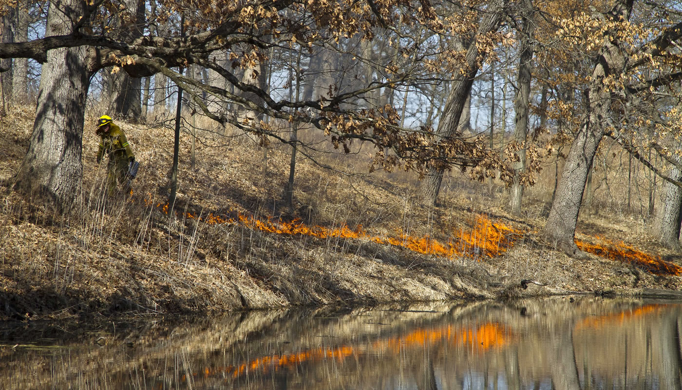
The satisfying crunch of fallen leaves beneath feet and the feeling of cool, crisp air against skin are expected when enjoying an autumn walk in the Forest Preserves of Cook County. But some visitors may also be surprised by encountering the sounds and smell of crackling fire as professional burn crews now head out for the biannual prescribed burn season.
To help folks navigate which sites are undergoing prescribed burns—an effective land management tool used on fire-dependent habitats—the Forest Preserves unveiled its new Prescribed Burn Activity Map, found at fpdcc.com/prescribed-burning. Using the map, visitors can find where burns are planned for the day as well as where burns were recently completed. The map will be updated daily during prescribed burn seasons in fall and spring.
“The new Prescribed Burn Activity Map helps Forest Preserves visitors plan an outing on the trails, helping them to avoids locations that may have increased smoke,” explains Forest Preserves General Superintendent Arnold Randall. “It also is a resource for nearby neighbors to see where activity is occurring.”
Prescribed burning mimics wildfires that our native prairies and woodlands have adapted to over millennia. Fire and heat suppress woody vegetation and invasive plant species, allowing the native plants of tall and short grass prairies and savannas in the Midwest to flourish The black earth left behind after a fire also warms more quickly in spring sunlight, which gives native species a jumpstart in growth over unburned areas. Other benefits include accelerated nutrient cycling in the soil and decreased fuel loads that will reduce the likelihood of wildfire.
Trained crews burn in the Forest Preserves where conditions are right for safety, smoke management and the type of burn needed in any given habitat. Before any fire hits the landscape, an extensive burn plan is developed for each site that specifies the proper weather conditions to minimize smoke impacts to area residences, businesses, schools and roads.
“Safety of our crews and the public is our biggest priority as we carry out prescribed burns in the Forest Preserves. The burn plans also include potential hazards and safety issues, procedures for ignition, acceptable weather and fuel conditions, personnel and equipment needs, and the management goals and objectives for the burn,” explains John McCabe, director of resource management and president of the Illinois Prescribed Fire Council.
Prescribed burns in the Forest Preserves are conducted within specific seasonal windows, starting in mid-October and mid-April, aligning with the dormancy of vegetation and wildlife.
“Protecting nature doesn’t stop at merely acquiring land. Nature in urban areas faces constant threats from invasive plants and animals, pollution and human development,” says McCabe. “To fulfill our mission of restoring the Forest Preserves to health, multiple restoration techniques are necessary, from brush removal and seed collecting to the use of fire.”
To learn more about prescribed burns or to view the new Prescribed Burn Activity Map, visit fpdcc.com/prescribed-burning.
###
About the Forest Preserves of Cook County
Don’t you sometimes just want to escape? Explore the natural beauty of Cook County for an hour, a day or even a night. When you’re surrounded by 70,000 acres of wild and wonderful there’s no better place to feel free.