The Forest Preserves of Cook County is working on projects across various sections of the extensive Des Plaines River Trail System to improve trail user experience, enhance safety and better connect surrounding communities to the Forest Preserves.
On this page:
- Improvements from North Ave to Touhy Ave
- Rail Crossing Improvement Between Golf Ave & Central Ave
- Catherine Chevalier Woods Bridge
- South Extension Planning Study
Improvements from North Ave to Touhy Ave
In 2019, the Village of Rosemont hired engineering consultants to conduct a preliminary engineering study for a 10-mile segment of the Des Plaines River Trail System from North Ave to Touhy Ave on behalf of the Forest Preserves and Des Plaines River Trail Advisory Group, which includes the West Central Municipal Conference, transportation agencies and bicycle advocacy organizations. The study identified improvements to address issues like flooding, safety at roadway and railroad crossings, trail access and trail user experience.
The study was divided into two parts: the North Section (Touhy Ave to Irving Park Rd) and the South Section (Irving Park Rd to North Ave). This allowed easier projects in the North Section to proceed sooner, helped build momentum for more challenging infrastructure improvements south of Irving Park Rd, and allowed more time for the study of a “Prairie Path Connector” south of North Ave.
The engineering study was funded by grants to the Village of Rosemont from the Cook County Department of Transportation’s Invest in Cook program and the West Central Municipal Conference and was vital in securing additional grants for projects in the North Section.
North Section (Touhy Ave to Irving Park Rd)
The 5.4-mile North Section (Touhy Ave to Irving Park Rd) is on higher and drier ground away from the river, which has put it on a faster track than the wetter South Section.
The preliminary engineering study for this section was approved by the Illinois Department of Transportation (IDOT) in 2021, and over $15 million in funding for engineering and construction has been secured by the Forest Preserves and three municipalities for the following trail improvement segments:
- Touhy Ave to Devon Ave: The City of Park Ridge was awarded $2 million in Illinois Transportation Enhancement Program (ITEP) and other state funds for trail improvements, including standardizing the width and texture of the trail, re-routing the mid-block crossing at Touhy Ave to a signaled intersection at Talcott Rd, and creating an at-grade crossing at the intersection of Devon Ave and Dee Rd. The work also included trail resurfacing and upgrading two crossings to improve visibility between trail users and motorists. These improvements created better connections to the Des Plaines River Trail for residents and commuters using the trail for leisure and transportation.
- Devon Ave to Bryn Mawr Ave: The Village of Rosemont received $1.6 million in ITEP and other state funds to cover 100% of the costs for trail reconstruction and improving crossings at Higgins Rd and Dee Rd. Construction activities included enhancements to pedestrian intersections at both Bryn Mawr Ave and Higgins Ave. Additionally, the trail surfacing on the existing bridge over I-90 was changed from stone to asphalt, creating a smoother, more manageable surface on the slopes.
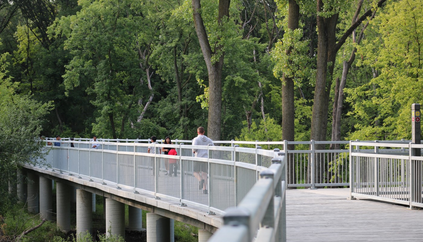
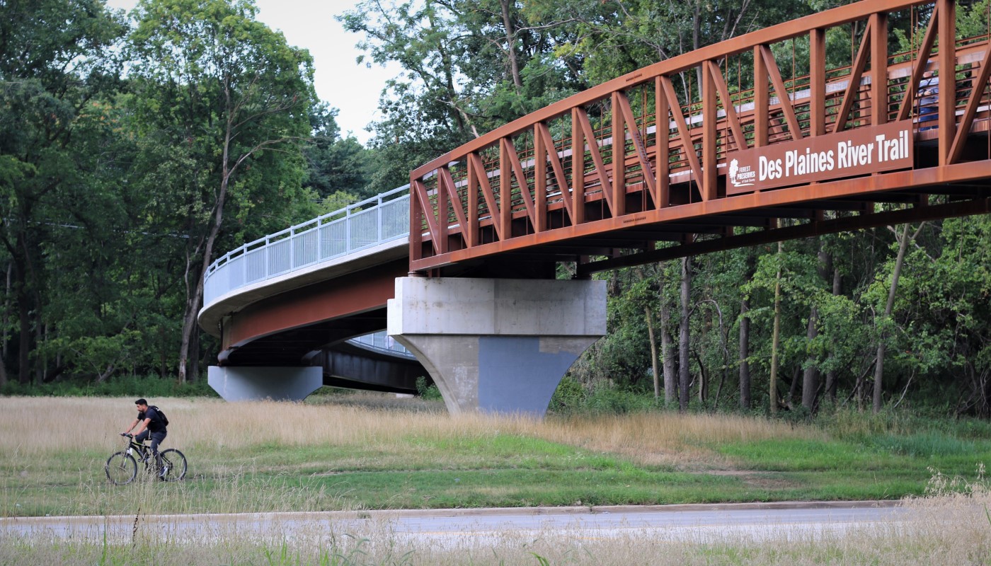
- Bryn Mawr Ave to Lawrence Ave: The Forest Preserves invested approximately $600,000 in local motor fuel tax (MFT) dollars for engineering. Additionally, it was awarded $7.9 million in Congestion Mitigation Air Quality (CMAQ) and Transportation Alternatives Program (TAP) funds, which account for 80% of the funding for construction. The work included repairing and upgrading the unpaved trail surface, which involved adding about 1,000 feet of boardwalk in a section near the river that frequently floods to raise the path profile above the 100-year river flood elevation. A pedestrian bridge was installed to take trail users over Lawrence Ave. Moreover, additional access at the southwest corner of East River Rd and Lawrence Ave was created by re-routing an existing trail to drier ground adjacent to Lawrence Ave, as the original trail was typically unusable due to wet conditions. Signal and ADA improvements were also part of this project at the intersection of East River Rd and Lawrence Ave.
- Lawrence Ave to Irving Park Rd: The Forest Preserves’ CMAQ grant award (see above) also includes $3.5 million for construction and engineering to relocate this trail segment away from the river and out of the floodplain. ITEP grant funds have been awarded to the Village of Schiller Park with a 10% local match from the Forest Preserves. Forest Preserves local match funds for this segment, and Bryn Mawr to Lawrence are motor fuel tax funds provided through an agreement with the Cook County Department of Transportation & Highways.
South Section (Irving Park Rd to North Ave)
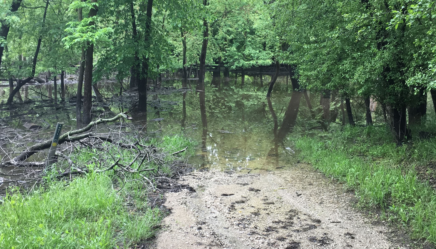
The 4.9-mile South Section (Irving Park Rd to North Ave) closely follows the river and experiences more frequent and longer periods of flooding than the North Section. The preliminary engineering study analyzed these flooding issues, along with road crossings and trail conflicts with railroad tracks and private property, and considered three alternatives:
- Moving the trail out of the 100-year flood plain and away from the river would impact mature woodland and stream habitats.
- Keeping the current alignment by building an expensive six to eight-foot elevated boardwalk to raise the trail out of the floodplain.
- Rerouting of the trail about a mile to the east, closer to Cumberland Rd.
Ultimately, rerouting the trail closer to Cumberland Rd south of Irving Park Rd to Forest Preserve Drive was selected as the most effective way to address flooding and road crossing issues, while minimizing expense and impact on natural areas. While preliminary engineering and cost estimates are complete funding partners have not yet been identified for more detailed engineering or construction for the section between Irving Park Rd and Fullerton Avenue. For the final section south of Fullerton Avenue, the Village of River Grove has received grant funding from Cook County for detailed engineering and the Forest Preserves has received a major federal grant has already been awarded for construction. Detailed engineering is expected to begin by late 2024.
Prairie Path Connection (North Ave to Madison St)
The study area was extended roughly three miles south of North Ave to consider alternatives for connecting the Des Plaines River Trail to the Illinois Prairie Path at Madison St in Forest Park. Additional funding is needed to complete the study for these additional miles, but the preliminary alignment is for an on-street bike route along Thatcher Ave in River Forest.
Project Resources
- Active Transportation Alliance 2018 Des Plaines River Trail Corridor Plan (PDF)
- February 2020 Open House Presentation (PDF)
- North Section (Touhy Ave to Irving Park Rd) Map (PDF)
- South Section (Irving Park Rd to North Ave) Map (PDF)
Rail Crossing Improvement Between Golf Rd & Central Rd
The Union Pacific Railroad tracks north of Golf Rd and south of Central Rd significantly interrupt the Des Plaines River Trail System’s continuity, present an unsafe environment for trail users and discourage residents of neighboring communities from using the trail. To close this trail gap, the Forest Preserves will realign the trail and construct a bridge over the railroad tracks.
The Forest Preserves is working with other key stakeholders on this project: the Illinois Department of Transportation, Cook County Division of Transportation, Union Pacific Railroad, Illinois Commerce Commission and ComEd, which has powerline towers in the vicinity.
Options for different alignments for the bridge were presented at a public Open House on May 17, 2019, at the Des Plaines Public Library. More than 30 attendees viewed and commented on the exhibits, asked questions of the staff and consultants and provided feedback on the trail.
Funding for engineering, construction and construction engineering has been awarded from the Cook County Department of Transportation (Invest in Cook), federal grants (Congestion Mitigation and Air Quality Improvement Program) and the Illinois Commerce Commission (Grade Crossing Protection Fund).
As of April 2024, the project is in engineering design, which involves preparing the construction documents. Construction is expected to be completed at a later date following IDOT’s approval of the project plans and the finalization of the local funding agreement.
Project Resources
Catherine Chevalier Woods Bridge
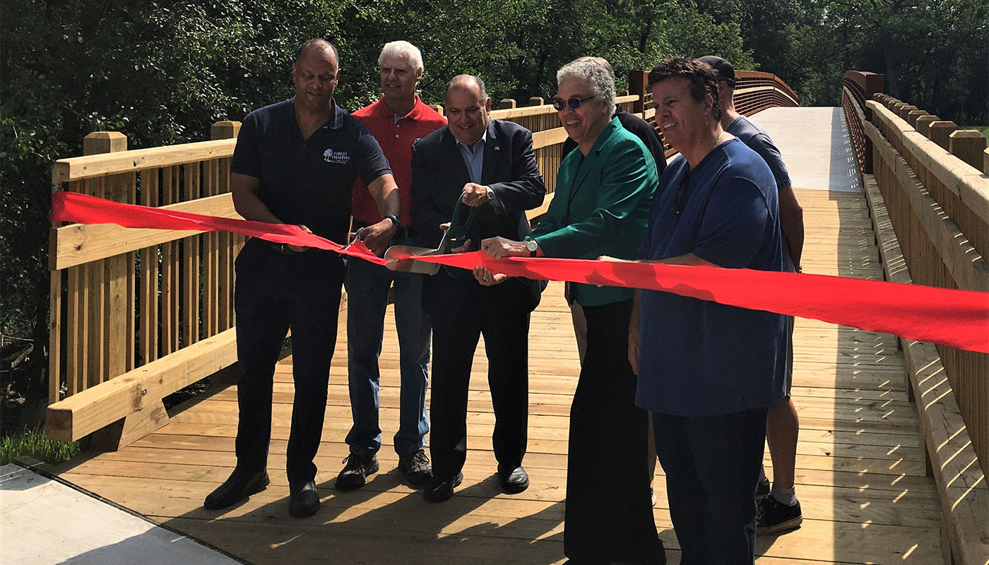
A 12-foot wide bridge over the Des Plaines River now connects Rosemont to the Des Plaines River Trail, from Bryn Mawr Ave on the west side of the river to Catherine Chevalier Woods on the east. The bridge gives Rosemont residents and visitors direct bike and pedestrian access to the trail.
The State of Illinois (80%) and the Village of Rosemont (20%) funded this $1.3 million project. Construction began in August 2020, and the bridge opened in June 2021.
South Extension Planning Study
Salt Creek Trail to Chicago Portage
The Des Plaines River Trail System currently ends at Sunset Bridge Meadow, just north of North Ave. There is a gap, or missing segment, approximately 6.5 miles in length between North Ave and Ogden Ave. South of this gap, in the Village of Lyons, the Des Plaines River Trail runs for approximately 1.3 miles from the Cermak Family Aquatic Center on Ogden Ave south to the Chicago Portage National Historic Site.
A planning study focused on the southernmost segment of the gap between W 26th St and Ogden Ave was completed in November 2019. The goal of the project is to identify the most feasible alignment or route in this area, along with key community connector routes in the villages of Brookfield, Riverside, North Riverside and Lyons. This study was done through a CMAP Local Technical Assistance project.
The West Central Municipal Conference is taking the lead on the next step to completing a study in 2020. STP funds will cover 80% of the costs, and the Forest Preserves, along with area municipalities, will provide the 20% match.
This study is a first step toward closing the entire 6.5-mile gap and creating a connection between the Illinois Prairie Path and Salt Creek Greenway.
Current Activities
The Chicago Metropolitan Agency for Planning (CMAP) is leading the planning study: