The Chicago Portage National Historic Site—one of only two National Historic Sites in Illinois—marks the western end of the historic portage linking the Great Lakes to the Mississippi River. The site includes a section of the Salt Creek Trail System, including an unpaved loop.
On this page:
- Location & Things to Do
- Trails
- Site Plans & Improvements
- History & Nature Notes
- Volunteer Opportunities
Location & Things to Do
Chicago Portage National Historic Site
Entrance
Things to Do & Amenities
- Parking
- Accessible Portable Bathroom
- Trail Access
- Hiking & Walking
- Bicycling
- Dogs
(on-leash only) - Cross-Country Skiing
- Volunteer Opportunities
Hours
Year-round: Sunrise to SunsetClosures & Alerts
Trails
Salt Creek Trail System
The Salt Creek Trail System’s paved and unpaved trails run along the Des Plaines River, Salt Creek and Brookfield Zoo, offering visitors views of a glacial valley, gravelly moraine and Salt Creek’s unique pool and riffle environment.
Location: Brookfield, Forest View, La Grange Park, Lyons, McCook, North Riverside, Oak Brook, Riverside, Westchester & Western Springs
Surface
Paved & UnpavedEstimated Total Length
16.4 milesHours
Year-round: Sunrise to SunsetClosures & Alerts
Site Plans & Improvements
Released in December 2018, the Chicago Portage Historic Site Master Plan serves to guide future decisions regarding upgrades, programs, and strategies for enhancing the Portage Site.
History & Nature Notes
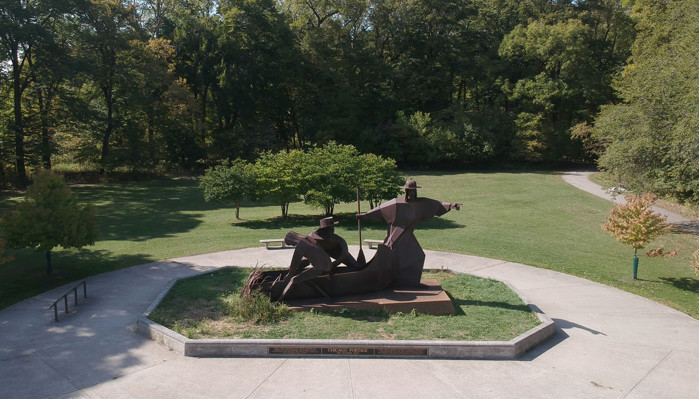
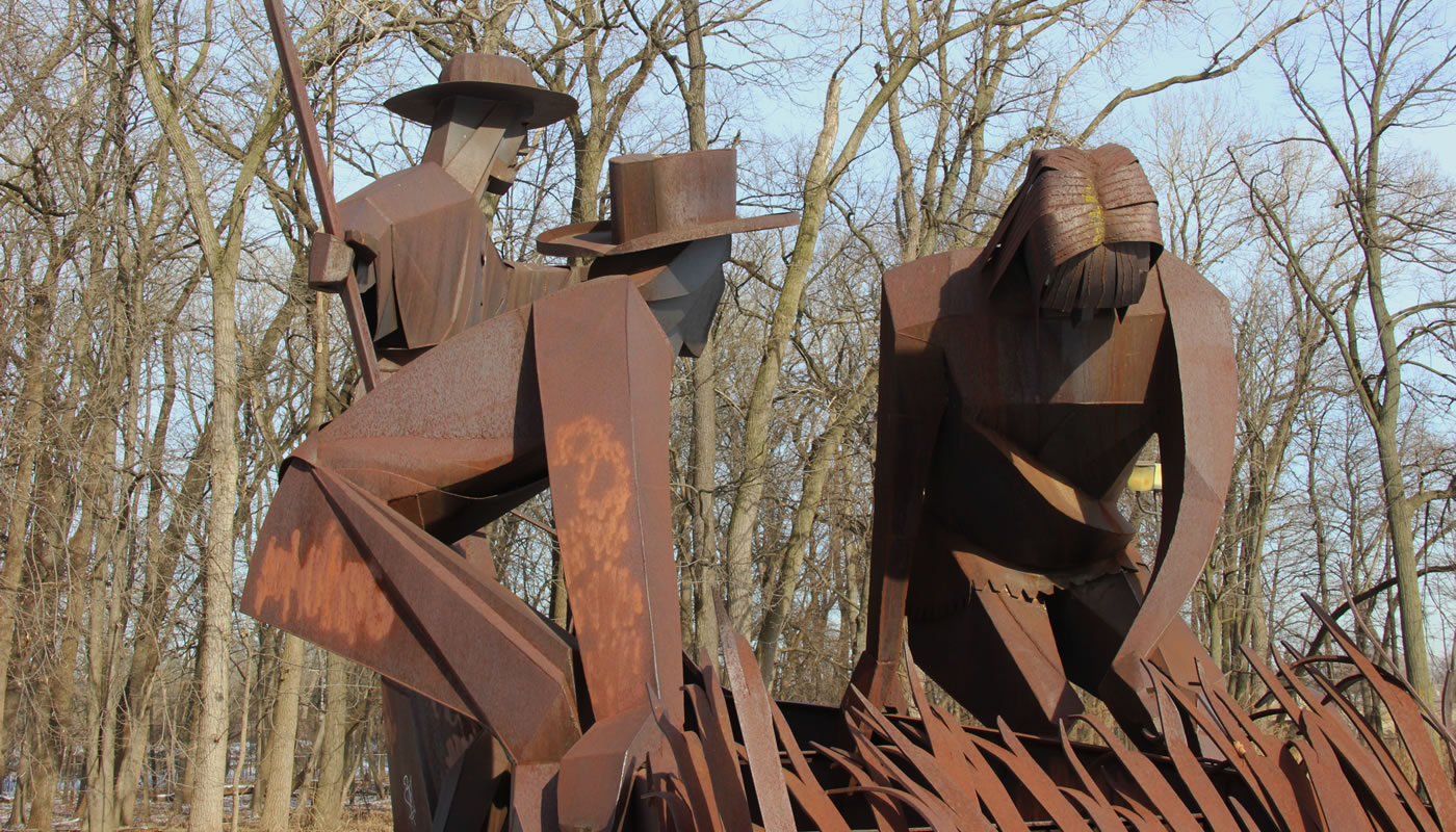
Situated on the east side of the Des Plaines River, the Chicago Portage National Historic Site commemorates the history of the connection between the Des Plaines River and the South Branch of the Chicago River. First as a seasonal water route or portage used by Native Americans and later as the Illinois and Michigan (I&M) Canal, then Chicago Sanitary and Ship Canal, this connection allowed travel between the Great Lakes and Mississippi River, significantly influencing the development of the City of Chicago and the Midwest region.
A Native American Passage
Formerly a complex of swamp, river, floodplain forest and prairie, this area bordered a narrow seven-and-a-half-mile-long swamp, later named Mud Lake. Native Americans used the route to travel between the Des Plaines River and the South Branch of the Chicago River, and therefore from the waters of the Great Lakes to the Mississippi River and Gulf of Mexico. When water levels were high, Mud Lake served as the missing link in a complete water route. When water levels were lower, travelers would need to portage—carry their boats and cargo—between the rivers to avoid the swampy Mud Lake.
Joliet & Marquette
In 1673, the Kaskaskia tribe shared knowledge of the portage with French explorer Louis Joliet and missionary Father Jacques Marquette, who were travelling north through what would become Illinois after exploring the Upper Mississippi River. Joliet and Marquette witnessed how the portage cut time on their return trip and saw the opportunity to increase the speed of travel and trade across the continent. Joliet believed that digging a canal along the route could create a more permanent and efficient connection between the Great Lakes and the Gulf of Mexico.
Building the Canals
The idea to dig a canal between the Des Plaines River and South Branch of the Chicago River persisted even as the dynamics of the area changed over the next 150 years. The U.S. Federal Government and settlers forced Native people out of the area, culminating in a series of treaties between 1816 and 1833 that transferred what is now Cook County, including the portage route, from Native groups to the U.S. Federal Government.
Gurdon Hubbard, who had experienced the frustrations of the portage as a fur trader, was the main advocate for the construction of a canal between the two rivers and lobbied for its construction during his time in the Illinois House of Representatives. Work on the canal began in 1836, and the I&M Canal officially opened in 1848. The canal and newly established railroad connections helped position Chicago as a center of trade, fueling historic population increases over the rest of the century.
The ongoing development in the region further changed the landscape surrounding the Chicago Portage. As the city’s population grew, concerns over sewage in the Chicago River entering Lake Michigan—the source of the city’s drinking water—led to the construction of the Chicago Sanitary and Ship Canal in 1900. Now part of the Illinois Waterway system, the Chicago Sanitary and Ship Canal reversed the flow of the Chicago River and eventually replaced the I&M Canal, which officially closed to transportation in 1933.
The construction of the canals altered the hydrology and ecosystems of the Chicago Portage site significantly. An artificial levee to the west—installed during construction of the I&M Canal—severed the connection to the Des Plaines River and permanently transformed the area’s original wet character.
Today’s Chicago Portage
The 50-acre Chicago Portage site was purchased by the Forest Preserves in 1921 and dedicated as a National Historic Site in 1952 because of its historic and cultural importance. Despite few remaining similarities to the portage route the Kaskaskia tribe shared with Joliet and Marquette in 1673, the legacy of the old portage still impacts our lives today, having shaped the routes of railroads, industrial corridors, and the Stevenson Expressway (I-55).
The Forest Preserves manages this natural area to promote the success of surviving native plant communities. The Chicago Portage site retains an open water marsh, floodplain forest, woodland, and savanna. Stewardship of the preserve is focused on the removal of invasive species, native plant enhancements, and prescribed burning to increase native plant habitat.
To learn more about the history of the site, visit the National Park Service’s Chicago Portage page or the Friends of the Chicago Portage website. The Friends of the Chicago Portage holds regular interpretive tours of the site.
The Chicago Portage National Historic Site is a unit of the National Park System but owned by the Forest Preserves of Cook County. To obtain an NPS cancellation stamp, please reach out to:
- Little Red Schoolhouse Nature Center at 708-839-6897 to arrange a time to receive a stamp at 9800 Willow Springs Rd, Willow Springs, IL 60480. A stamp for the I&M Canal National Heritage Area is also available at this location.
- Forest Preserves Resource Management Department at resourcemanagement.fpcc@cookcountyil.gov to arrange a time to receive a stamp at the Forest Preserves General Headquarters (536 N Harlem Ave, Chicago, IL 60305).
Volunteer Opportunities
Since 2002, the Friends of the Chicago Portage have been working year-round to return native plant communities to the Portage area, as well as keeping the trails clean and clear. Join a group of volunteers working to restore native habitat by removing invasive brush, collecting seeds and pulling weeds.