Palos Trail System

mountain bikers on the Palos single track trails
Mountain bikers navigate the Palos single track trails during the annual Palos Meltdown Mountain Bike Festival and Race.

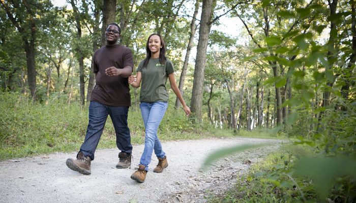
The extensive and varied Palos Trail System winds through rolling hills and deep ravines, providing beautiful views of the surrounding landscapes.

On this page:


Overview & Maps

Palos Trail System

Location: Hickory Hills, Justice, Palos Hills & Willow Springs

Surface

Unpaved

Estimated Total Length

42.1 miles

Hours

Year-round: Sunrise to Sunset

Closures & Alerts

*Please be a courteous trail user: Follow posted signs and our trail rules and etiquette.

a mountain biker participating in a race on the Palos Trail System

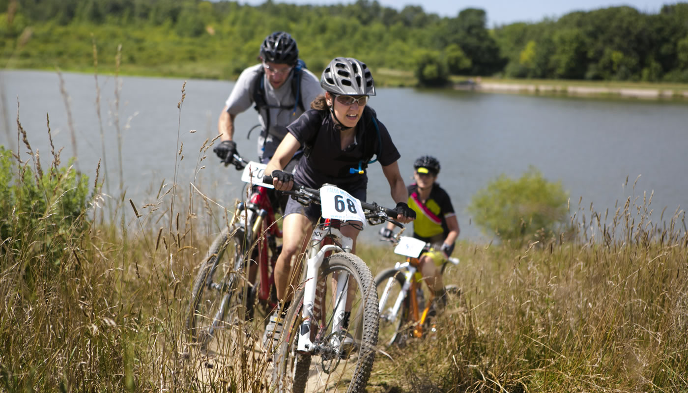
Mountain Biking at Palos

Rolling hills, deep ravines and beautiful views make the Palos Trail System one of the premier places for mountain biking in Illinois.

The Palos Trail System includes designated single track trails. These unpaved trails are narrow and designed for mountain biking, hiking and equestrian use. E-bikes are not allowed on these trails.


Trail Access

Access the Palos Trail System at any of these forest preserve locations (ordered from West to East). Check out the trail maps listed above to find on-street or bikeway access points.


Red Gate Woods
S Archer Ave, northeast of 107th St
Cook County, IL 60480 (view web map of Red Gate Woods)
(near Willow Springs)

Bullfrog Lake
Wolf Rd, south of 95th St
Cook County, IL 60480 (view web map of Bullfrog Lake)
(near Willow Springs)

Pulaski Woods-South
Wolf Rd, south of 95th St
Cook County, IL 60480 (view web map of Pulaski Woods-South)
(near Willow Springs)

Wolf Road Woods
Wolf Rd, south of 95th St
Cook County, IL 60480 (view web map of Wolf Road Woods)
(near Willow Springs)

Maple Lake-East – Mountain Bike Staging Area
95th St, west of Willow Springs Rd/Flavin Rd
(near Willow Springs)

Willow Springs Woods
Willow Springs Rd, southeast of S Archer Ave
Cook County, IL 60480 (view web map of Willow Springs Woods)
(near Willow Springs)

Camp Kiwanis Equestrian Staging Area
Willow Springs Rd, south of 95th St
(near Willow Springs)

Saganashkee Slough-East
S Willow Springs Rd/104th Ave, north of Calumet Sag Rd/Rte 83
(near Willow Springs)

Pioneer Woods
107th St, east of S Willow Springs Rd/Flavin Rd
Cook County, IL 60480 (view web map of Pioneer Woods)
(near Willow Springs)

Country Lane Woods
95th St, east of Flavin Rd/Willow Springs Rd
Cook County, IL 60480 (view web map of Country Lane Woods)
(near Willow Springs)

Spears Woods
96th Ave, south of W 87th St
Cook County, IL 60480 (view web map of Spears Woods)
(near Willow Springs)

Hidden Pond Woods-West
96th Ave, north of W 95th St
(near Willow Springs)

Buffalo Woods-South
W 87th St, west of S Kean Ave
Cook County, IL 60480 (view web map of Buffalo Woods-South)
(near Willow Springs)

Buffalo Woods-Central
S Kean Ave, north of W 87th St
(near Willow Springs)

Buffalo Woods-North
S Kean Ave, north of W 87th St
Cook County, IL 60480 (view web map of Buffalo Woods-North)
(near Willow Springs)

Hidden Pond Woods-East
S Kean Ave, north of W 95th St
(near Willow Springs)

two people hiking on the Palos Trail System

Recommended Hikes

Intermediate

Start and end at Country Lane Woods

  • Length: 5 miles
  • Surface: Unpaved
  • Terrain: Rolling

Get to know the Palos Trails by starting at Country Lane Woods and hiking the rolling terrain around Cranberry Slough Nature Preserve, one of only a few peat bogs in Illinois.

The trail starts with an old gravel country lane that provides a wide path for hiking, biking, cross-country skiing or horseback riding through the heart of the preserve. Head south along the Tan Unpaved Trail to the intersection with the Yellow Unpaved Trail. Continue southeast on the Yellow Unpaved Trail, then around to Cranberry Slough.

This ecological restoration site provides great viewing for wildlife as well as delicate woodland and prairie wildflowers.

Hike another 2.5-miles, then rejoin the northern portion of the Tan Unpaved Trail. Head south back to your starting point.


Country Lane Woods
95th St, east of Flavin Rd/Willow Springs Rd
Cook County, IL 60480 (view web map of Country Lane Woods)
(near Willow Springs)

Advanced

Start and end at Wolf Road Woods

  • Length: 5.5 miles
  • Surface: Unpaved
  • Terrain: Hilly

For a more strenuous adventure, hike or mountain bike the 5.5-mile Orange Unpaved Loop trail from Wolf Road Woods. This natural trail is twisting, rocky and narrow with varied topography.

Pick up the trail just north of the parking lot at Wolf Road Woods, and continue along past scenic Tomahawk and Horsecollar Sloughs.

Follow the outer trail loop as it winds south along Archer Avenue, then east along 107th Street. This area provides colorful autumn foliage and is home to a great variety and abundance of wildlife.

From there, continue following the trail north, up a challenging incline and finally back to the starting point.


Wolf Road Woods
Wolf Rd, south of 95th St
Cook County, IL 60480 (view web map of Wolf Road Woods)
(near Willow Springs)